Projects
Reality capture: How it works.
The drone flies an automated survey grid over the site, capturing dozens or hundreds of photographs.
Advanced software transforms these images into fully-scaled and geolocated orthographs (maps) and 3D models.
My goal is to provide deliverables in file sizes and formats that fit your workflow. A variety of data products can be customized to fit your needs.
I specialize in providing civil engineering, survey and GIS professionals with high-accuracy, ground control point corrected map layers.
-
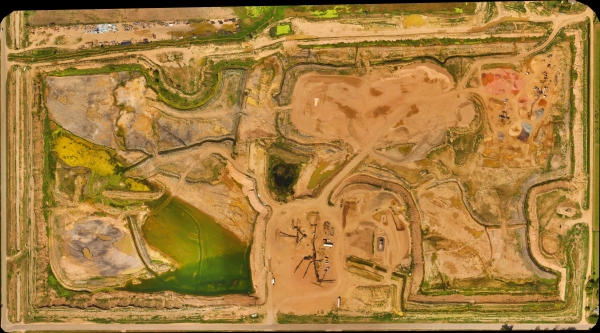 Full-Color OrthographsHigh-resolution, geolocated and fully-scaled maps. Document and monitor change. Get a whole new perspective. Make distance and area measurements.
 -
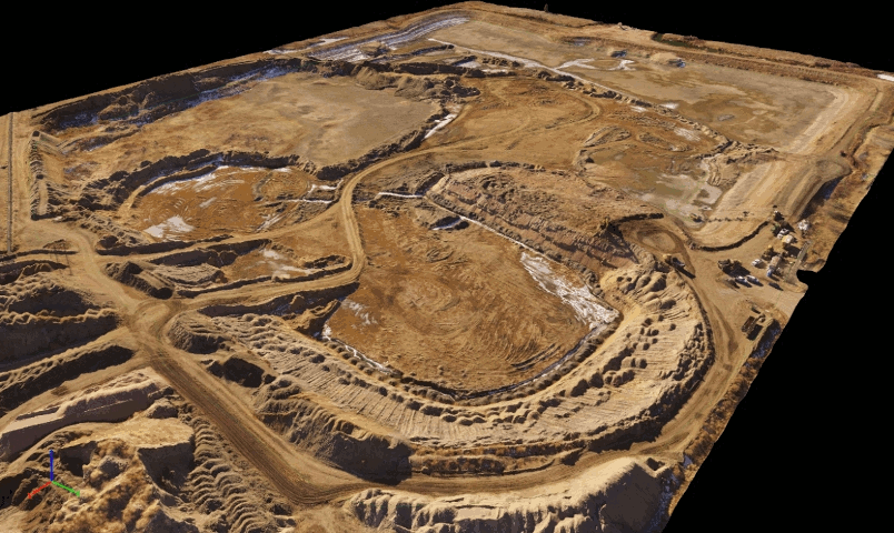 Reservoir Capacity Analysis3D volumetrics and 3D surface area measurements for informed decision making.
 -
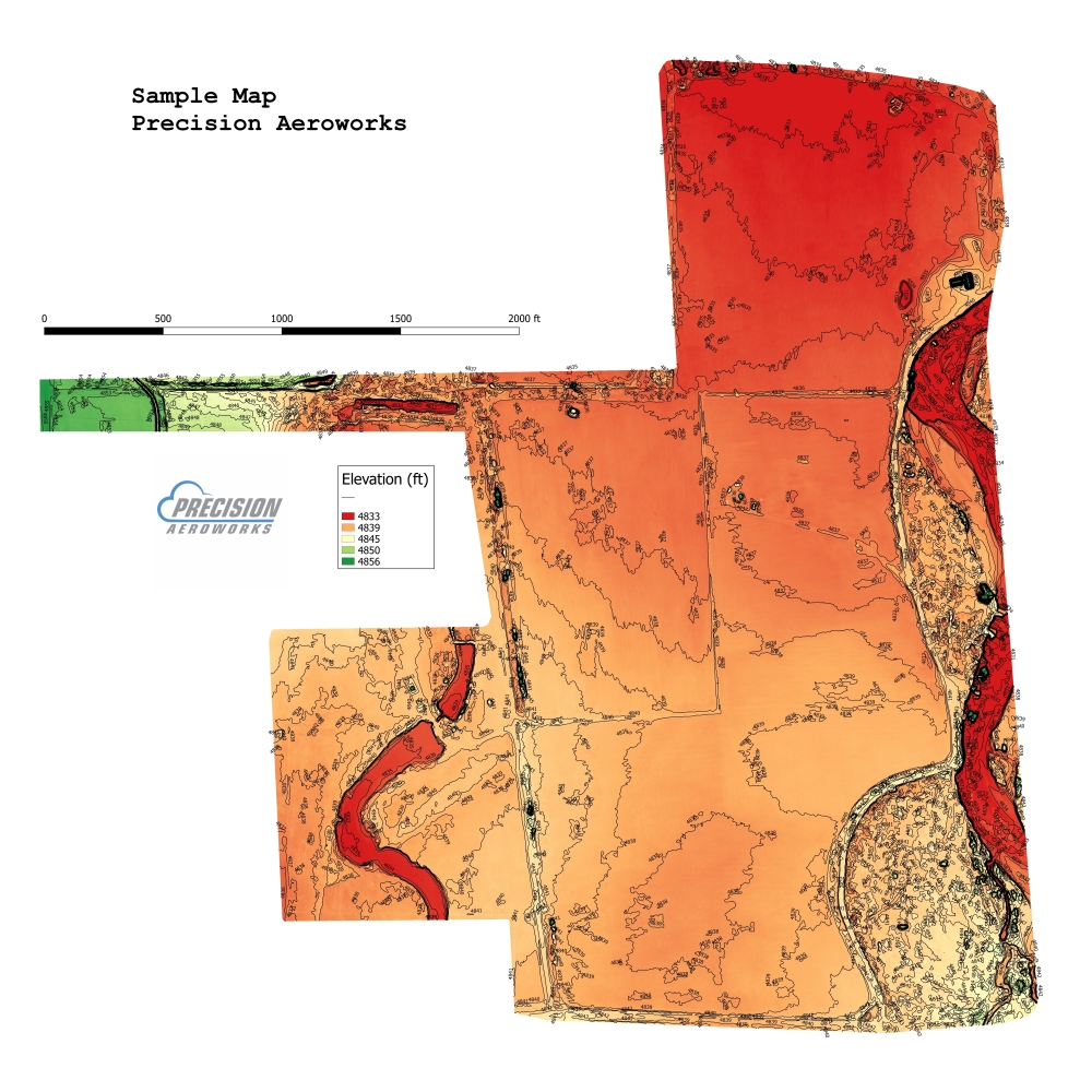
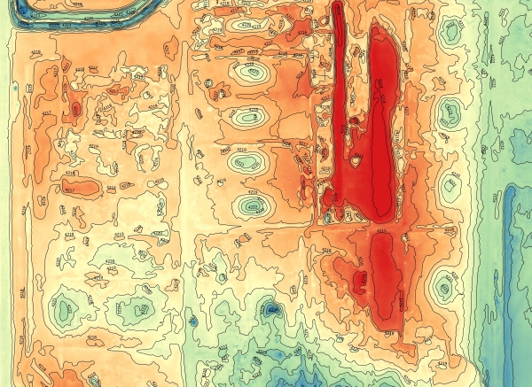 DTM and Contour MapsDigital Terrain Maps and contour maps. Export formats for any CAD or engineering software system. Standard 1 ft contours in DXF or SHP file formats available.
 -
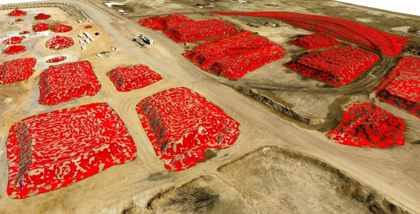 Stockpile VolumetricsFast, safe and accurate stockpile inventory.